
SITE DEVELOPMENT
Travis Basnett, PE · Licensed in SC, NC & GA · 11-minute read
Before the trees come down, someone has already worked out whether the land, the rules, the infrastructure and the numbers can support a neighborhood.
You've driven past the same wooded property for years. One morning, trees are coming down. Equipment is moving dirt. A sign announces a new neighborhood.
It feels sudden. By then, developers, surveyors, engineers, utilities and government reviewers have already spent months, sometimes years, working through whether the project can happen.
Before the first house, someone has to figure out whether the land can support a neighborhood, design how it will work, show that the numbers make sense and obtain permission to build it.
To follow that process, imagine a 40-acre wooded tract beside a two-lane road in the Midlands. A developer pictures 100 homes. The property will have something to say about that.
The work described here overlaps, and a problem in one area can send the team back to another.
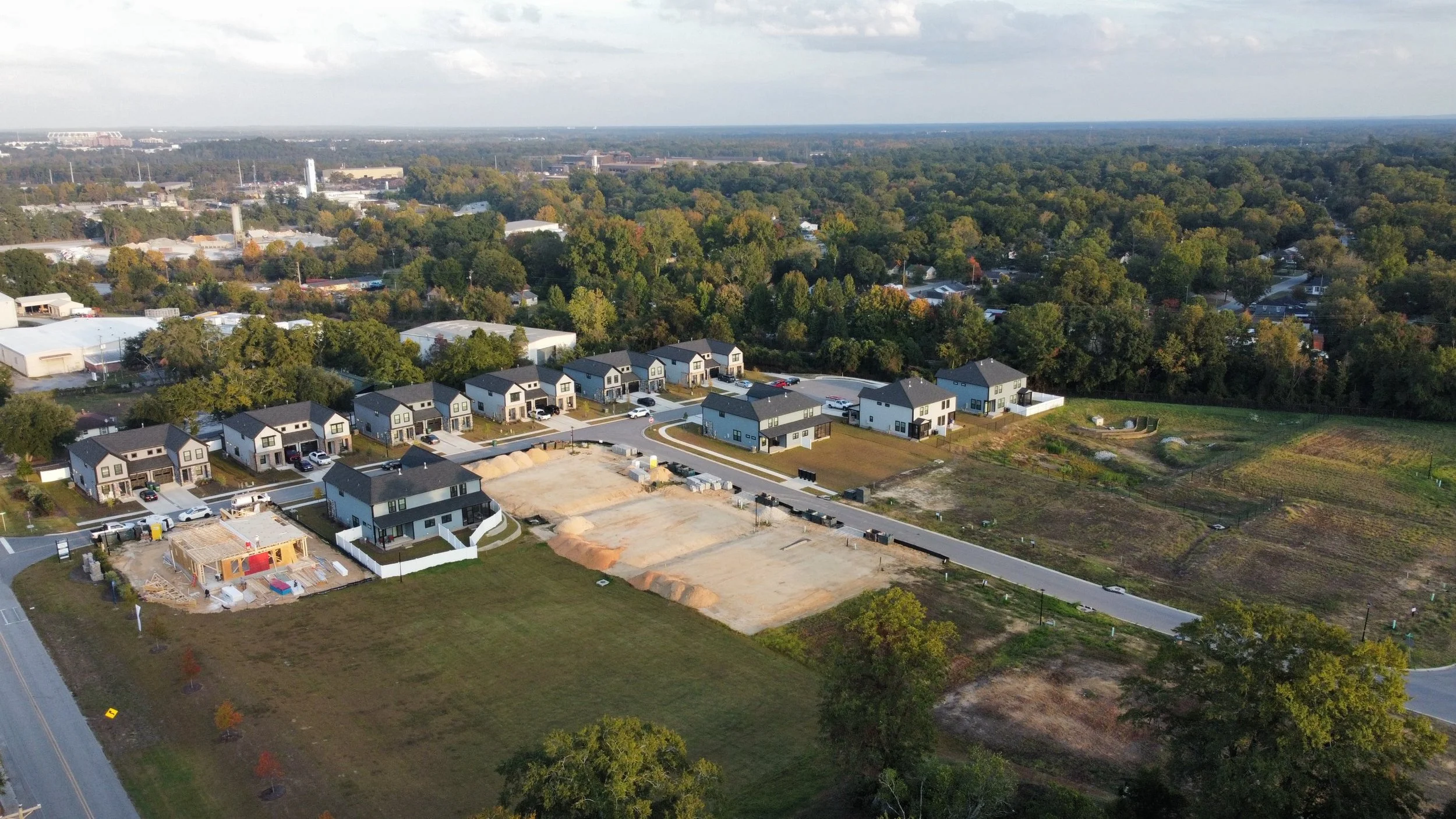
A neighborhood under construction in the Midlands: finished homes on new streets, a house being framed, graded lots waiting for slabs and a stormwater basin at right. Photo by the author.
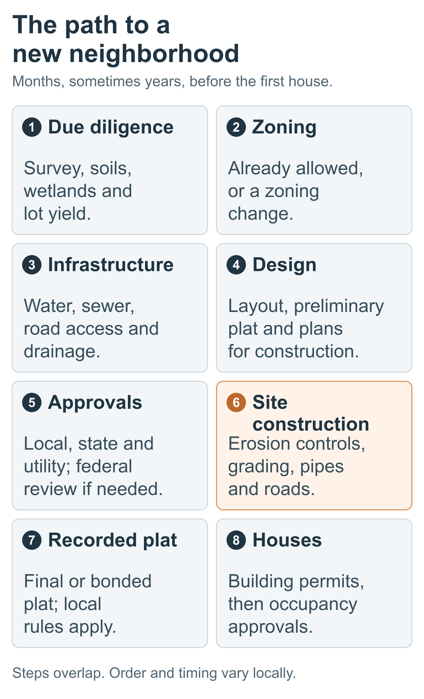
Figure 1. The typical path from due diligence to houses. Steps overlap, and the order and timing vary by project and jurisdiction.
Can this land become a neighborhood?
A developer often starts investigating before completing the purchase. A purchase contract can provide time for due diligence: studying the property and deciding whether to proceed.
One early question sounds simple: how many lots might fit?
Dividing 40 acres by a proposed lot size won't answer it. Streets consume land. So do ponds, utility corridors and required buffers. A creek can divide the property into pieces that are expensive to connect.
A civil engineer prepares a yield study, a rough layout estimating how many lots might fit under the zoning rules and the property's physical constraints. That estimate gives the developer something to compare with the cost of buying and improving the land.
Other specialists investigate the property itself.
A surveyor establishes the boundaries and maps the ground elevations. Easements can give someone else rights across the property, limiting where houses or roads can go.
An environmental consultant identifies wetlands and streams. A Phase I environmental site assessment examines the property's history and other evidence for signs of contamination. Protected species or historic resources can trigger additional investigation.
A geotechnical engineer studies the soil and rock. Soft ground needs different treatment from firm soil. Shallow rock makes digging expensive. High groundwater can complicate foundations, sewers and ponds.
The civil engineer brings those findings into the layout and checks floodplain, access, utility connections and drainage. A line on a map is only useful if it can actually be built.
On our illustrative property, wetlands along a creek, space for drainage and road layout requirements reduce the usable area. The working plan drops from 100 lots to 72. Reaching public sewer also requires a long extension, and its cost now has to be spread across 72 lots instead of 100.
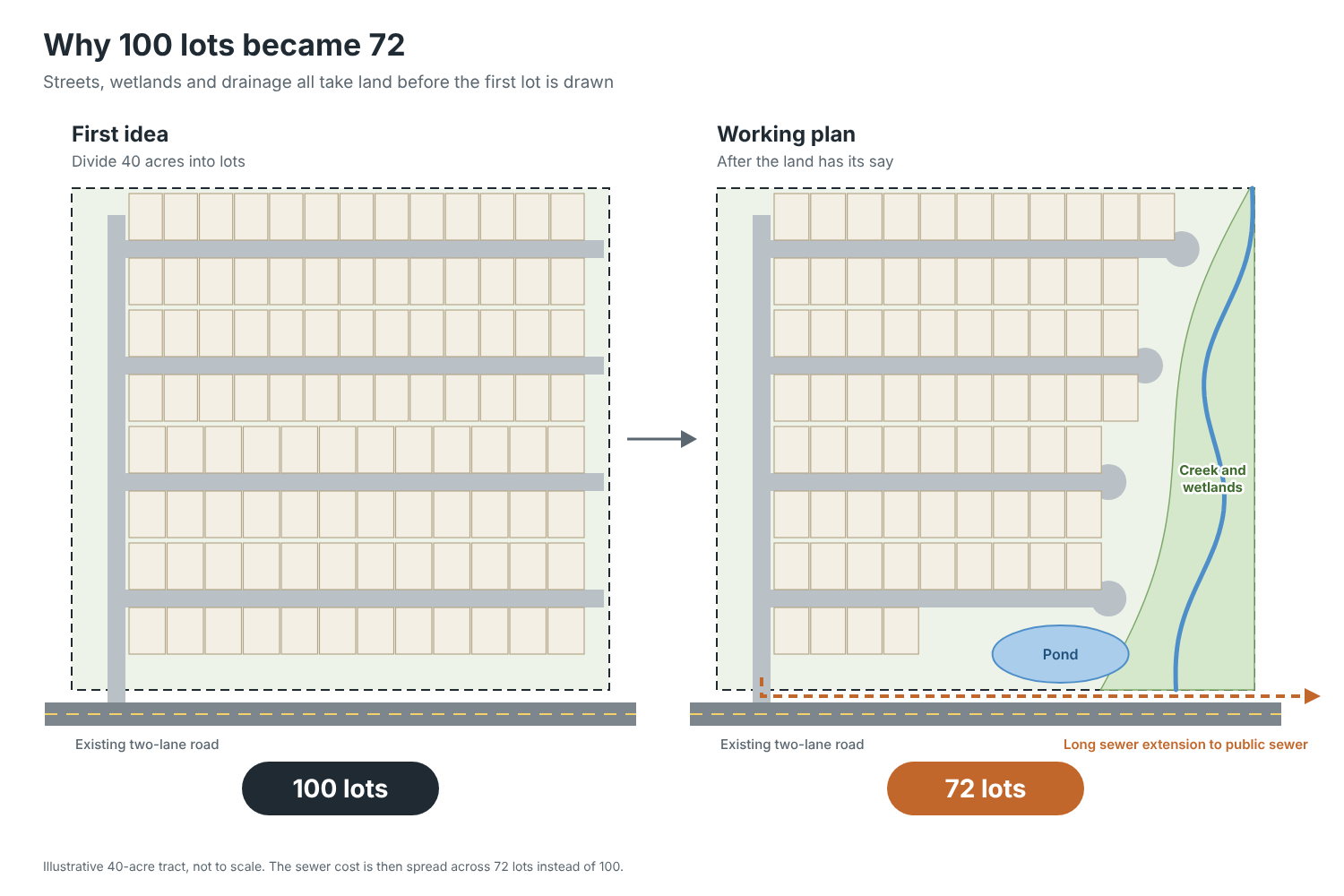
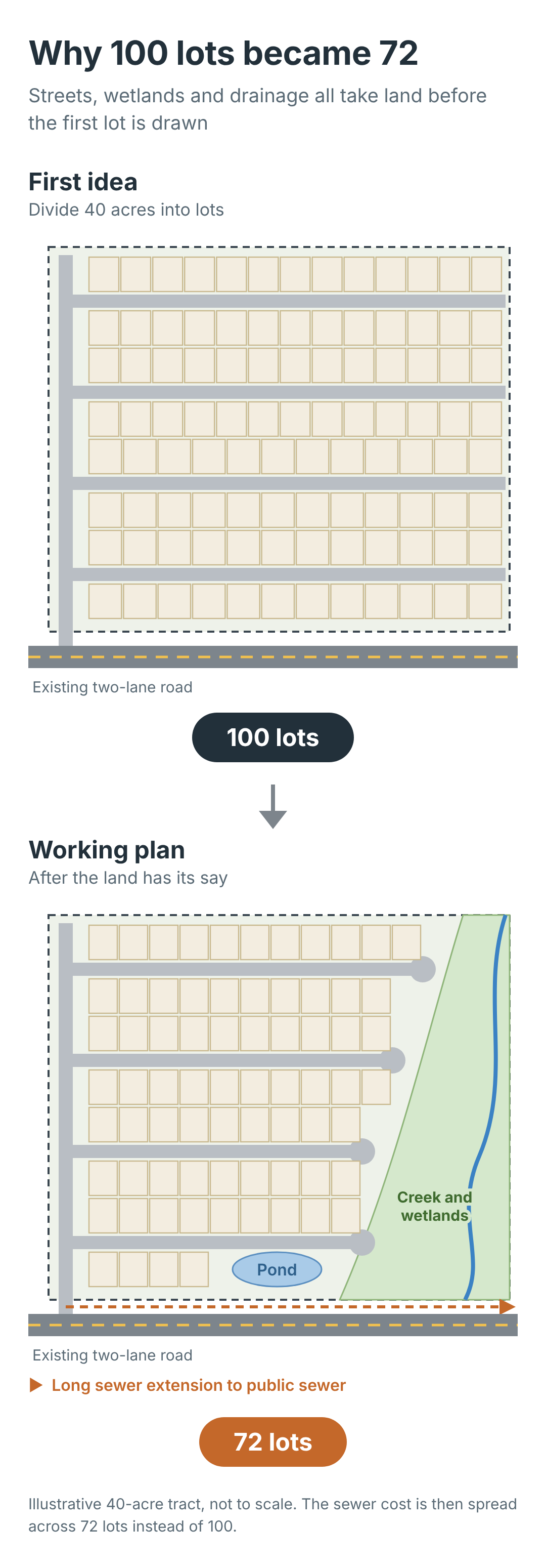
Figure 2. The same 40-acre tract before and after the land has its say. Wetlands, drainage and street layout reduce the plan from 100 lots to 72. Illustrative, not to scale.
The developer now has fewer lots to carry the land price, roads, pipes, permitting and financing. The budget also needs room for unexpected conditions and a return that makes the investment worthwhile. Study costs accumulate before closing; after purchase, financing and other carrying costs can continue long before lot sales begin.
Some properties get redesigned. On others, the numbers don't work. Depending on the purchase contract, the developer may walk away before closing, leaving the property undeveloped for now. Finding that out before buying land or moving dirt is a useful result.
What do the land-use rules allow?
Zoning establishes the uses and development patterns allowed on a property. It addresses things such as housing types, density, lot dimensions and setbacks, the required distances between buildings and property lines.
Wooded land can already be zoned for houses. Its appearance doesn't tell you what the rules allow.
If the proposed neighborhood fits the existing zoning, the developer generally proceeds through subdivision and other required development reviews. Staff or a planning commission review the plan under the adopted rules. That process does not necessarily include a rezoning hearing or a vote by elected officials.
If the developer needs a zoning change to build the proposed housing or density, the request takes another path. Public notice, planning commission review and a public hearing give residents opportunities to speak before council decides whether to change the rules. [1]
This distinction explains some of the surprise when clearing begins. Neighbors might expect a new vote on whether houses belong there. The zoning decision allowing them could have happened years earlier.
Deciding what uses a community will allow is different from checking whether a particular design meets its standards. Engineers review drainage calculations and road grades. Elected officials adopt zoning rules and decide requests to change them.
Certain development approvals also establish vested rights. In South Carolina, approval of a qualifying site-specific development plan generally provides a two-year right to carry out that plan, with extensions available under specified conditions. Local rules determine which approval triggers that protection. Vesting protects against certain later rule changes; it does not replace the remaining permits or eliminate all later requirements. [1]
Residents can ask questions throughout the process, but the decisions still open for discussion change with the stage. Specific concerns about drainage, access or compliance may still need attention after the zoning question is settled. Knowing the stage helps residents direct a concern to the decision-maker who can address it. If you care about land nearby, learn its zoning while it is still wooded.
Can the infrastructure support another neighborhood?
Permission to build houses doesn't create capacity in the systems around them.
Start with water. A main beside the property needs enough capacity and pressure for the proposed homes and firefighting demand. The utility evaluates service and identifies extensions or improvements. A willingness-to-serve letter states the utility's willingness to serve and any conditions.
Sewer has another set of questions. Is there capacity in the collection system and treatment plant? Can sewage flow downhill to the connection, or will it need a pump station? Can the developer obtain easements across neighboring land? A private developer generally must negotiate for those easements. If a key owner says no, the route may have to change, or the project may stall.
For our 72-lot plan, the long sewer extension remains a substantial expense. Without a workable public connection, the developer must determine whether septic systems are feasible and how their land requirements would change the layout, or reconsider the project.
The entrance also needs more than a convenient opening in the trees. Drivers need enough sight distance to enter and leave safely. Traffic analysis can identify turn lanes or other improvements. Emergency access requirements also influence street connections and room for fire trucks to maneuver.
Developers typically pay for the entrance and improvements required of their projects. Utilities also commonly charge tap or capacity fees for each new connection, and some local governments charge impact fees toward roads, parks or public safety.
Then there is rain. Woods intercept rainfall and allow water to soak into the ground. Roofs and pavement send more of it running across the surface. Engineers design drainage routes, pipes and ponds around that change, including how water reaches the downstream system. Meeting a drainage standard does not eliminate every possibility of flooding.
On one property, water, sewer, roads and drainage all have to work together.
How does an idea become construction plans?
The concept starts with rough streets, lots and pond locations. The subdivision layout, often called a preliminary plat, adds dimensions, setbacks and easements. Construction plans establish the elevations, pipe sizes, pavement sections and details a contractor needs to build the work.
Each step tests whether the pieces still fit together.
Our developer asks the engineer to test whether 10 more lots, taking the plan from 72 to 82, would pay off. On this property, reaching those lots requires a longer street. The extra pavement and rooftops increase runoff. On this layout, the added runoff requires more pond storage and a larger footprint, taking land intended for lots.
The additional street, pipes and earthwork also cost money. After the engineer redraws the layout and the developer updates the budget, the expansion adds fewer usable lots than expected, and their projected sales no longer justify the extra construction cost. The plan stays at 72.
That is a central part of civil engineering: balancing a connected system. Improving the lot count on one drawing can make the drainage or construction cost worse on another.
The hardest puzzle often happens vertically. A driveway must connect the garage to the road at a usable slope. Sewer pipes need to reach their connection at the right depth. Ground around houses must direct water toward planned drainage routes.
Engineers coordinate those elevations, then estimate where dirt must be cut from high areas and placed in low ones. Moving suitable soil within the property can reduce the need to haul material in or out.
This also explains some of the clearing. Roads, utilities and ponds need working room. Changing the ground elevation around a tree can kill it even if the trunk stays untouched. Digging a trench cuts through roots, and burying roots under fill can damage or kill the tree.
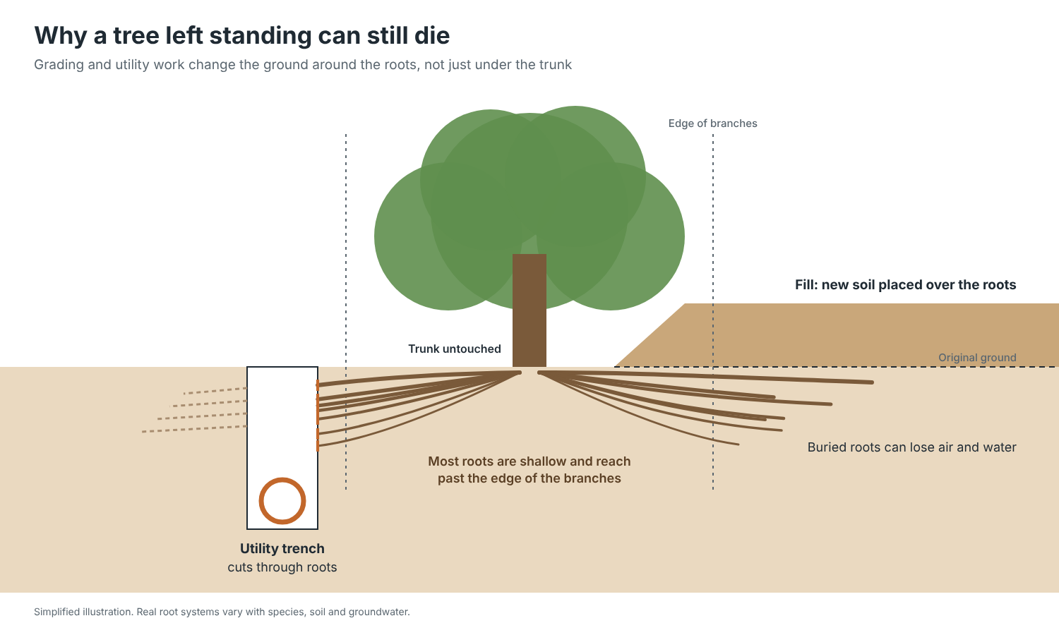
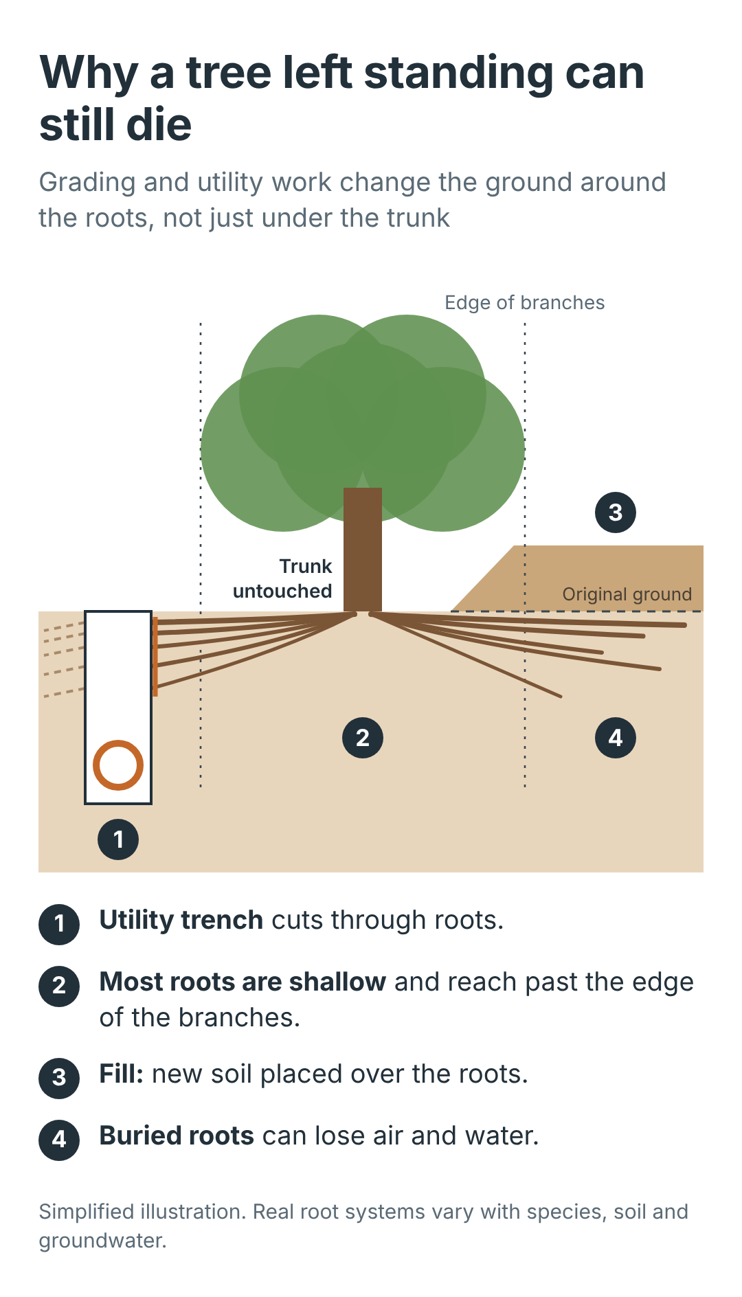
Figure 3. A tree left standing can still be lost. A utility trench cuts through roots, and fill buries them. Simplified illustration.
Saving trees takes deliberate choices, such as shifting a street, adding a retaining wall or leaving an area ungraded. Sometimes those choices reduce lot count or increase cost. When a feasible preservation option is rejected because of its cost, the clearing reflects an economic choice rather than an unavoidable site constraint, and it's fair to say so.
Which approvals does construction require?
Every city and county handles this a little differently. In South Carolina, the city or county reviews subdivision requirements and applicable local road, drainage and fire access standards. Construction stormwater permit coverage comes through the South Carolina Department of Environmental Services, or SCDES. Depending on the location, local stormwater approval is also required before coverage can be issued. Water and sewer construction have their own approvals. [2, 3]
An entrance involving state-maintained road right-of-way needs an SCDOT encroachment permit: permission to work within that right-of-way. Work placing fill in federally regulated wetlands or streams can require U.S. Army Corps of Engineers approval. [4, 5]
On our 72-lot property, those reviews stack up. The city or county checks the layout, streets and drainage. The agency responsible for the existing road reviews the entrance. If the road is state-maintained, that means SCDOT. If the sewer extension crosses the creek or its wetlands, the Corps may need to weigh in. The water and sewer extensions need both utility approval and state construction permits.
Reviewers issue comments; the design team revises and resubmits. Some decisions depend on others, so these reviews overlap without all finishing together.
What people call “the permit” is usually a collection of approvals, each covering a different part of the project. Each part of construction must wait for the approvals required for that work.
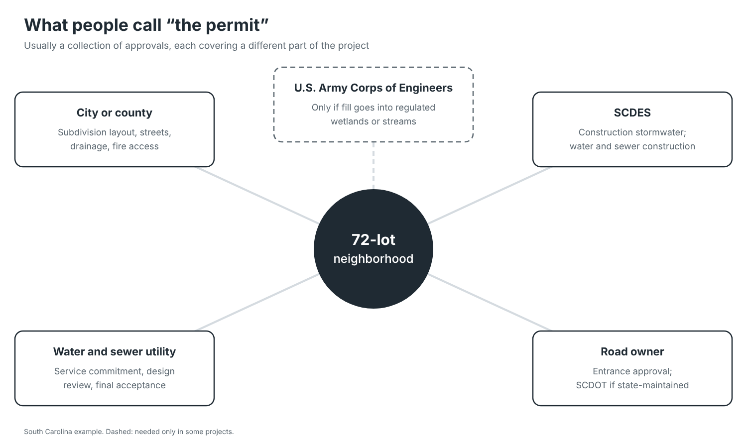
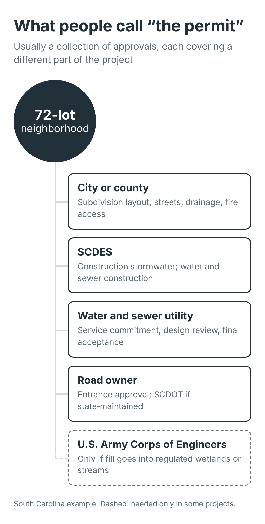
Figure 4. What people call “the permit” is usually several approvals. South Carolina example; the Corps of Engineers is involved only in some projects.
What happens when construction starts?
Construction proceeds in overlapping stages. Crews can be installing utilities in one area while another is still being graded.
Erosion controls come first, starting with the work needed to install them. A stabilized entrance limits mud tracked onto the road. Silt fence and sediment basins help keep soil on the site.
Rainfall runoff exists before construction. Exposing soil gives that water something new to carry. Sediment can cloud streams, damage aquatic habitat and clog drainage systems. Keeping muddy water out of creeks requires maintaining the controls as work changes. [2]
Crews clear within the approved limits, stockpile usable topsoil and move earth to the planned elevations. Fill is placed and compacted in layers so future roads and building areas have suitable support.
Water, sewer and storm drainage go underground. Inspectors check installation, and crews perform the required tests. Water lines need pressure testing, disinfection and required water-quality testing; sewer and storm systems have their own checks.
Crews construct the road's prepared foundation, curbs and gutters where included, stone base and pavement in the sequence required by the plans. The final asphalt surface often waits until much of the house construction is complete, reducing damage from heavy construction traffic.
The approved drainage and sediment-control measures must function throughout construction. A basin used to collect construction sediment may later be cleaned out and converted to its permanent stormwater role. Exposed soil is stabilized as work progresses, using temporary or permanent cover as appropriate. [2, 6]
Inspection happens throughout. Compaction results, pipe tests and field observations help establish whether the work meets the plans before the next layer covers it.
Waiting until the end would leave too much hidden. Checking a pipe joint or the soil beneath a road is far easier while crews can still reach it.
When can the houses begin?
A subdivision plat is a survey map showing the individual lots, streets and easements. The plat approved and recorded for lot sales may be called a final plat or, in some communities, a bonded plat. Local requirements determine when those lots can be sold and when houses can begin. [1, 6]
Some communities allow that recording before specified improvements are complete if the developer provides approved financial security, such as a bond or letter of credit. It helps fund completion of the covered work if the developer defaults. [1, 6]
House construction can begin while some neighborhood work continues, once local requirements for building permits, access, utility arrangements and fire protection are satisfied. Permission to construct a utility extension is separate from approval to put it into service. Moving people in requires the applicable occupancy approvals and authorization to use the new utility systems. [3]
The developer usually pays to build the neighborhood roads, pipes and ponds. Those costs influence what the developer must recover through lot sales and what builders must recover through home sales.
Long-term maintenance depends on ownership and formal acceptance. Plat approval alone does not make a road public or transfer maintenance responsibility, though recording and acceptance can occur together under local procedures. Roads can become public or remain private. Water and sewer extensions intended for utility ownership require the utility's acceptance. Ponds often become a homeowners association (HOA) responsibility, including inspections, repairs and sediment removal. [1, 6]
The neighborhood you did not see being built
Return to the wooded tract. By the time equipment arrives, the imagined 100 lots have become a workable plan for 72. Decisions about land, roads, drainage and money have already shaped what you will see.
To research a wooded tract in the Midlands:
Look it up on Richland County's GIS maps or Lexington County's Planning and GIS resources, then confirm the jurisdiction and zoning with the planning office.
Follow planning commission agendas and council hearing notices for the city or county with jurisdiction. Midlands resources include Columbia, Richland County and Lexington County.
Ask planning staff for submitted plans, existing approvals, and any remaining decisions or opportunities for public comment.
Construction didn't start with the bulldozer. It started with a question: can this land support what someone imagined building here?
Sources
All sources accessed October 2026.
[2] SCDES Construction Stormwater Program.
[3] SCDES Water and Wastewater Construction Permit Application and Wastewater Construction Permitting. See also public-water construction and operation requirements and SCDES wastewater permitting and authorization to place systems into service.
[4] SCDOT Encroachment Permits.
[5] U.S. Army Corps of Engineers Permitting Overview.
[6] Lexington County Subdivision Ordinance, Article 6; and Land Development Manual, stormwater management requirements.
From the same series
What Happens When You Turn On the Faucet? Follow the public water system backward, from the tap to its source.
What Happens After You Flush? Follow wastewater in the other direction.
What Happens When It Rains? Where rain goes after it falls.
What Happens When You Drive to Work? Why every road on your commute is built for a different job.
What Happens When You Drive Over a Bridge? Follow your car’s weight from the tire to the dirt.
What Infrastructure Does a Data Center Actually Use? How a data center’s design determines what it needs from the infrastructure around it.
This article is part of a series explaining how the systems around us actually work, written for people who are not engineers.
Coming in the series: What Happens When the Power Goes Out?
Curious how a system near you actually works? I write these to make everyday infrastructure legible. I also provide expert witness support and limited independent technical review for civil site, drainage and utility infrastructure disputes.
About the Author
Travis Basnett, PE is a civil engineer with 16 years of post-degree professional experience in civil site development, stormwater design, drainage evaluation and flooding investigations. He provides expert witness support and independent technical review for civil engineering disputes and is licensed in South Carolina, North Carolina and Georgia.
Disclaimer: This article is intended for general informational purposes and does not constitute legal or engineering advice regarding any specific property, project or matter.
Graphics note: The diagrams in this article were created with AI assistance and reviewed by the author. They are simplified and not to scale. The aerial photo was taken by the author.